Introduction
Geography photography is more than just capturing beautiful landscapes it’s about telling the story of our planet through images. Imagine a photographer standing on a quiet mountain ridge at sunrise, watching golden light spill across valleys, rivers, and distant towns. In that single moment, a photograph can capture not only the beauty of the scene, but also the relationship between land, climate, and human life. From towering mountain ranges and vast deserts to bustling cities and quiet coastlines, this form of photography reveals how people and environments are deeply connected.
By combining elements of art, science, and exploration, geography photography helps us understand natural processes, cultural landscapes, and the impact of human activity on the Earth. It has roots in early exploration, when photographers documented unfamiliar regions to share with the world, and it has since evolved into a powerful modern tool for storytelling and research. Today, with the rise of platforms like Instagram, images can reach global audiences instantly, shaping how we see and understand different places.
This makes geography photography more relevant than ever. In a time of climate change, rapid urban growth, and environmental challenges, photographs can raise awareness, influence public opinion, and inspire action. Whether you’re a beginner with a smartphone or an experienced photographer with professional gear, it offers a powerful way to document, appreciate, and share the world’s diverse and ever-changing environments.
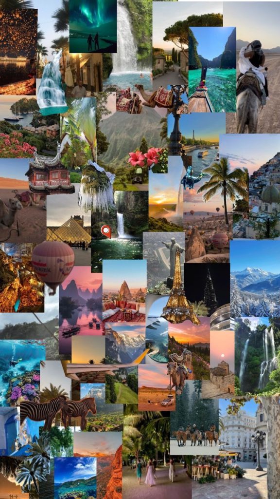
“A vibrant collage of travel scenes from around the world, featuring waterfalls, tropical beaches, hot air balloons, camels in the desert, mountain landscapes, historic architecture, city views like Paris with the Eiffel Tower, Asian temples, lush greenery, and colorful sunsets, all layered together in a dynamic montage of global destinations.”
“Take your first step today capture one photo that tells the story of your surroundings. It could be your street, a park, or a nearby landscape. Don’t aim for perfect focus on light, composition, and meaning.”
What is Geography Photography
Geography photography is a specialized form of photography that focuses on capturing the physical features of the Earth and the ways humans interact with them. It goes beyond simply taking scenic pictures by emphasizing location, environment, and spatial relationships. This type of photography can include natural landscapes like mountains, rivers, and deserts, as well as human-made settings such as cities, farms, and transportation networks. The goal is not just to create visually appealing images, but to document and communicate geographic patterns, environmental changes, and cultural influences, helping viewers better understand the world and how it is shaped.
While it may seem similar to traditional landscape photography, geography photography has a broader purpose. Landscape photography often prioritizes beauty, composition, and artistic expression, focusing on creating visually striking images. In contrast, geography photography places greater emphasis on meaning and context. A photograph of a river, for example, is not just about its beauty it may also show erosion, water usage, or its importance to nearby communities. The image becomes a form of visual evidence, not just art.
Another key aspect of geography photography is the use of data, mapping, and context. Photographers often consider where an image was taken, why that location matters, and how it fits into larger geographic patterns. Tools like maps, coordinates, and geotagging help connect images to real-world locations, making them useful for research, education, and analysis. This ties closely to the field of Geography, which explores how natural systems and human activities interact across space. In this way, geography photography acts as a bridge between visual storytelling and scientific understanding, turning images into powerful tools for learning about our planet.
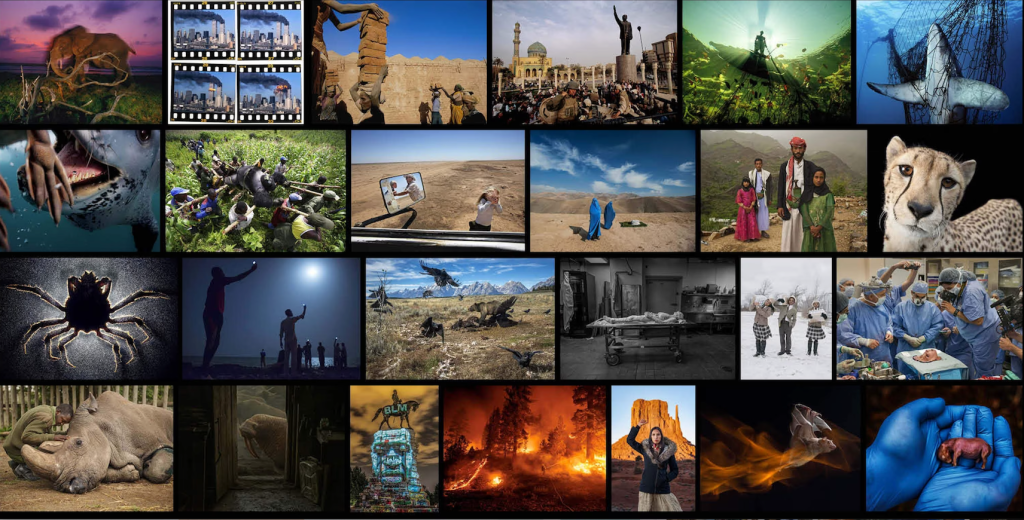
“A collage of powerful and emotional photographs showing a wide range of scenes, including wildlife (elephants, sharks, cheetahs), environmental destruction (wildfires, pollution), human conflict and war, medical procedures, cultural moments, and social issues, arranged in a grid with vivid colors and dramatic contrasts.”
History of Geography Photography
The history of geography photography dates back to the 19th century, when early photographers joined scientific expeditions to document parts of the world that were largely unknown to the wider public. At a time when travel was difficult and information was limited, photographs served as powerful visual records of distant landscapes, natural features, and cultures. Explorers used early cameras to capture mountains, rivers, and settlements, helping geographers and scientists study the Earth in ways that written descriptions alone could not achieve.
As photography developed, it became an essential tool for documenting both physical and human geography. Photographers played a key role in recording the expansion of cities, changes in land use, and the lives of people in different regions. During the early 20th century, figures like Ansel Adams brought attention to the beauty and importance of natural landscapes, using photography to promote environmental conservation. At the same time, photographers such as Dorothea Lange focused on human experiences, capturing powerful images that revealed social conditions, migration, and the impact of economic hardship on communities.
Over time, geography photography has evolved alongside technological advancements. The shift from film to digital cameras made photography more accessible and allowed for faster sharing and editing of images. Today, modern tools such as satellite imaging, GPS, and Drone photography provide entirely new perspectives, enabling photographers to capture large-scale geographic patterns from above. This evolution has transformed geography photography into a dynamic field that blends traditional techniques with cutting-edge technology, continuing to expand how we document and understand our world.
Why Geography Photography Matters
Geography photography matters because it helps us see and understand the world in a deeper, more meaningful way. By visually documenting landscapes, ecosystems, and human environments, it raises awareness about important issues such as climate change, urban development, and environmental conservation. These images can educate, inspire, and even influence decision-making by showing real-world impacts that might otherwise go unnoticed. Beyond its educational value, geography photography also preserves moments in time capturing places and cultures as they are today, which may change in the future. In this way, it serves as both a powerful storytelling tool and a visual record of our ever-evolving planet.
One of the most important roles of geography photography is its real-world impact. Photographs of melting glaciers, rising sea levels, and extreme weather events provide clear visual evidence of climate change, making complex scientific issues easier for the public to understand. Similarly, images of deforestation in tropical regions or pollution in oceans highlight environmental damage in a way that statistics alone often cannot. Urban expansion is another powerful subject photographs comparing cities over time can reveal how rapidly human development is reshaping the landscape.
Organizations like the National Geographic Society have long used photography to bring global issues to public attention, combining compelling visuals with scientific research. These images often play a role in influencing policy decisions, supporting conservation efforts, and encouraging sustainable practices.
What makes geography photography especially powerful is its emotional impact. While data and reports are essential, they can sometimes feel distant or abstract. A single photograph, however, can create an immediate emotional connection helping viewers feel the urgency of environmental challenges or the significance of cultural traditions. In this way, geography photography not only informs but also shapes public opinion, encouraging people to care about and protect the world around them.
“Want sharper, more powerful shots? Try the 3-step field method: observe carefully, wait for the right moment, and shoot multiple angles. Practice it every time you go out you’ll see the difference fast.”
Techniques
Techniques in geography photography focus on capturing both the beauty and meaning of a place. To do this effectively, photographers rely on a combination of creative and technical skills that help transform simple scenes into powerful visual stories.
Composition
Composition plays a key role in guiding how viewers experience an image. Techniques such as the rule of thirds, leading lines, and natural framing help direct the viewer’s eye and create balance within the photograph. Including foreground, middle ground, and background elements can add depth, making landscapes feel more immersive. In geography photography, composition is not just about aesthetics it also helps highlight spatial relationships, such as the connection between a city and its surrounding environment or the scale of natural features.
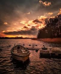
“Old wooden boats floating on a calm lake at sunset, with dramatic orange clouds reflecting on rippling water and a dark tree-lined shore in the background.”
Lighting
Lighting is equally important, as it sets the mood and tone of an image. Shooting during the golden hour shortly after sunrise or before sunset adds warmth, softer shadows, and depth. Overcast conditions can be useful for capturing even lighting and subtle details, while dramatic weather like storms or fog can create atmosphere and emotion. Understanding how light interacts with landscapes helps photographers emphasize textures, colors, and natural patterns.
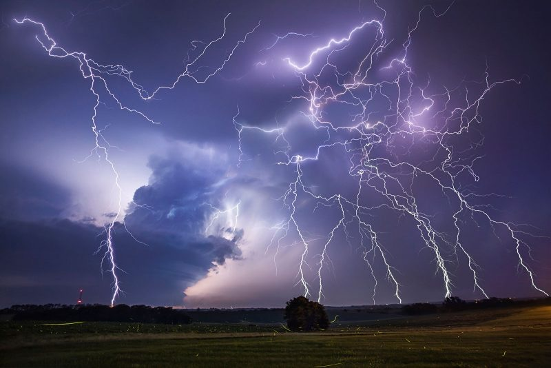
“A wide open field under a stormy sky filled with multiple branching lightning strikes illuminating dark clouds and the horizon at dusk.”
Timing & Seasons
Timing goes beyond just the time of day. Seasons can completely transform a location, from snow-covered mountains in winter to lush greenery in summer. Returning to the same place at different times allows photographers to document environmental changes and capture a wider range of geographic conditions. Patience is key waiting for the right moment can make a significant difference in the final image.
Equipment & Tools
Geography photography can be done with a variety of equipment, from smartphones to professional cameras. While DSLRs and mirrorless cameras offer greater control and image quality, smartphones are increasingly powerful and convenient for beginners. Advanced tools like Drone photography provide unique aerial perspectives, revealing patterns and spatial relationships that are not visible from the ground.
Using a tripod can help stabilize shots, especially in low light or when using long exposure techniques to capture movement in water, clouds, or city lights. Shooting in RAW format is also recommended, as it preserves more image data and allows for greater flexibility during editing. Post-processing tools like Adobe Lightroom and Adobe Photoshop can enhance colors, contrast, and clarity while maintaining the authenticity of the scene.
By combining these techniques, photographers can create images that are not only visually compelling but also rich in geographic meaning and context.
Physical Features & Geotagging
Physical features and geotagging play a crucial role in geography photography by adding both visual and informational value to images. Capturing physical features such as mountains, rivers, coastlines, and deserts helps highlight the natural processes that shape the Earth and gives viewers a clear sense of place. These features can reveal patterns like erosion, weathering, or vegetation distribution, turning a simple photograph into a visual explanation of how the environment works.
Geotagging enhances this by attaching precise location data to each photo, allowing photographers to document exactly where an image was taken. This becomes especially valuable in research and mapping, as geotagged images can be integrated into Geographic Information Systems (GIS) to analyze spatial patterns and environmental changes. Tools like Google Earth allow users to view and compare locations over time, making it easier to track changes such as deforestation, urban growth, or coastline shifts.
Geotagging also plays a major role in travel blogging and content creation. By sharing exact locations, photographers make it easier for others to discover and explore the same places, creating a more interactive and informative experience. Over time, collections of geotagged photos can build a visual record of how specific locations evolve, turning individual images into part of a larger geographic story.
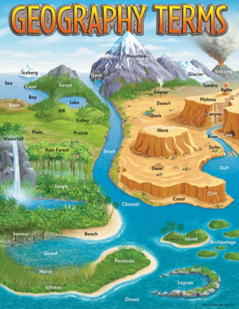
“A colorful illustrated map labeled “Geography Terms” showing various landforms and features such as mountains, rivers, deserts, forests, oceans, islands, valleys, plateaus, volcanoes, glaciers, and beaches, each clearly labeled within a vibrant landscape.”
Tips & Tricks for Beginners
For beginners in geography photography, the key is to start simple and focus on learning how to truly observe your surroundings. You don’t need expensive gear many great shots can be taken with a smartphone if you pay attention to composition, lighting, and timing. Shooting during early morning or late afternoon will give you softer, more flattering light, while experimenting with different angles can add depth and perspective to your images.
A helpful way to improve quickly is to follow a simple step-by-step workflow. First, research your location look at maps or photos to understand what features you want to capture. Next, arrive early and explore, paying attention to light, textures, and natural patterns. Then, compose your shot carefully, using techniques like leading lines or framing. After taking your photo, review and adjust, trying different angles or settings. Finally, edit lightly, enhancing the image without losing its natural look.
It’s also important to be aware of common mistakes. Over-editing is one of the biggest issues too much contrast, saturation, or filtering can make images look unrealistic. Poor framing can leave photos feeling unbalanced or cluttered, while ignoring the foreground and background can make images appear flat. Always try to include layers in your composition to create depth.
When it comes to gear, each option has its strengths. Smartphones are portable and easy to use, making them perfect for beginners. DSLR and mirrorless cameras offer more control over settings like exposure and focus, which can improve image quality as you gain experience. No matter what you use, the most important factor is how you see and capture the world around you. With practice, patience, and consistency, your skills will naturally improve over time.
“Your perspective deserves to be seen. Share your best geography photo today, tell the story behind it, and tag the location to connect your work to a global audience.”
Types of Geo-Photography
Types of geo-photography in geography photography vary based on what aspect of the Earth is being captured and studied. Each type offers a different perspective, helping photographers document both natural processes and human influence in meaningful ways.
Physical Landscape Photography
Physical landscape photography focuses on natural features such as mountains, rivers, forests, deserts, and coastlines. The goal is not only to capture scenic beauty but also to highlight geological formations, weather patterns, and natural processes like erosion or glaciation. These images often emphasize scale and depth, helping viewers understand the size and structure of the environment.
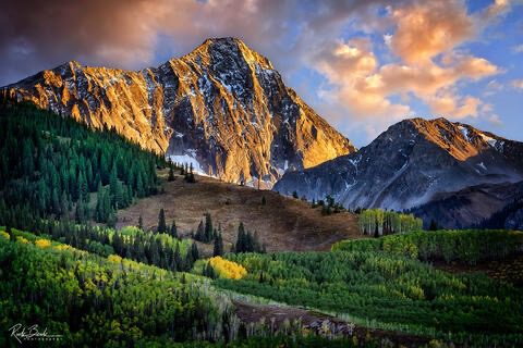
“Sunlit rocky mountain peaks rising above dense green forest, with golden light hitting the cliffs under a partly cloudy sky.”
Urban (Human Geography) Photography
Urban photography centers on cities, architecture, and human-made environments. It explores how people shape and organize space through buildings, roads, and infrastructure. This type of photography can reveal patterns of urban growth, population density, and cultural identity. From crowded city streets to quiet suburban areas, urban geo-photography shows how human activity transforms the landscape over time.
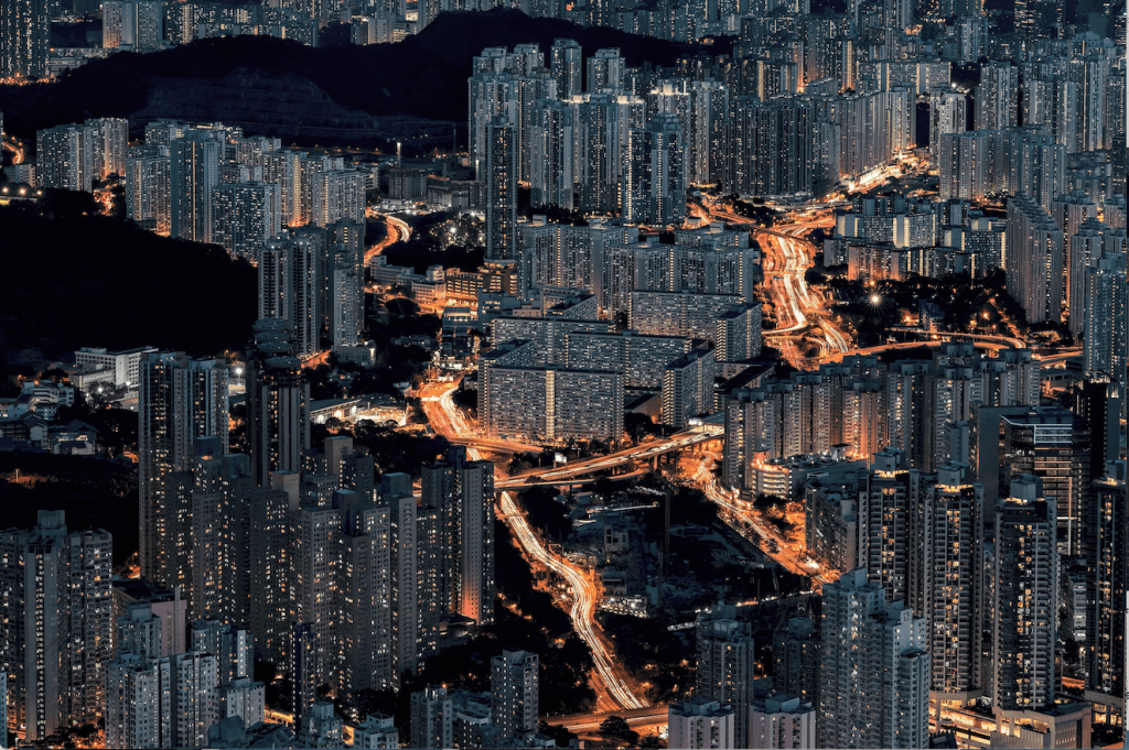
“A dense modern cityscape at night with high-rise apartment buildings and illuminated roads forming flowing light trails through the urban area.”
Environmental & Documentary Photography
Environmental or documentary photography focuses on real-world issues such as climate change, pollution, conservation, and natural disasters. These images often aim to raise awareness and inspire action by showing the impact of human activity on ecosystems. Whether documenting deforestation, endangered wildlife, or extreme weather events, this type of geo-photography plays an important role in education and advocacy.
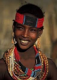
“A portrait of a young woman wearing traditional beaded jewelry and a red headband, smiling warmly.”
Aerial & Drone Photography
Aerial photography provides a broader perspective by capturing images from above, revealing patterns and spatial relationships that are not visible at ground level. Modern Drone photography has made this approach more accessible, allowing photographers to capture sweeping views of landscapes, cities, and coastlines. From mapping farmland to documenting urban expansion, aerial images offer valuable insights into how different geographic elements connect and interact.
Together, these types of geo-photography provide a comprehensive view of the Earth, combining artistic expression with scientific observation to deepen our understanding of the world.
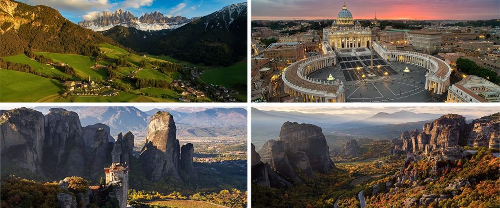
“A collage of four images showing an alpine valley with mountains, St. Peter’s Basilica and square at sunset, and two views of Meteora’s towering rock formations with monasteries overlooking scenic valleys.”
Ethics in Geography Photography
Ethics play a vital role in geography photography, as capturing the world also comes with the responsibility to respect it. Photographers are not just observers they are participants in the environments and communities they document. One of the most important considerations is respecting local cultures. When photographing people, traditions, or communities, it’s essential to seek permission when appropriate and avoid misrepresenting cultural practices. Images should aim to portray subjects with dignity and accuracy rather than reinforcing stereotypes or creating misleading narratives.
Avoiding exploitation is another key ethical concern. Geography photography often involves documenting vulnerable communities or environmental issues, and there is a risk of turning real struggles into visual content without context or sensitivity. Photographers should strive to tell honest stories, provide context, and avoid sensationalizing hardship for attention or aesthetic appeal. Responsible storytelling ensures that images inform and respect rather than exploit.
Environmental responsibility is equally important. Photographers should minimize their impact on natural environments by following guidelines such as staying on marked trails, avoiding damage to vegetation, and leaving no trace behind. Capturing the beauty of a place should never come at the cost of harming it.
Finally, respecting wildlife is essential in geography photography. Animals should never be disturbed, chased, or manipulated for the sake of a photograph. Keeping a safe and respectful distance helps protect both the subject and the photographer. By following ethical practices, geography photographers can ensure that their work not only documents the world but also helps preserve it for future generations.
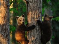
“Two young bears climbing a tree in a forest, one looking toward the camera while gripping the trunk, surrounded by green foliage and warm sunlight filtering through.”
Future of Geography Photography
The future of geography photography is closely tied to rapid advancements in technology and the growing need to understand our changing planet. One major development is the rise of AI-enhanced photography, where artificial intelligence is used to improve image quality, assist with editing, and even help analyze geographic patterns within photos. This allows photographers and researchers to process large amounts of visual data more efficiently and extract meaningful insights from images.
Satellite imaging is also becoming increasingly important. Modern satellites can capture highly detailed images of Earth’s surface, making it possible to monitor remote regions, track environmental changes, and study large-scale geographic patterns over time. Combined with tools like GIS, this data helps scientists observe deforestation, melting ice caps, and urban expansion with greater accuracy.
Another growing area is climate monitoring. Geography photography is now being used alongside scientific data to document the effects of climate change in real time, helping researchers and policymakers respond more effectively to environmental challenges.
Finally, social media continues to shape the future of geography photography. Platforms allow images to spread instantly across the globe, raising awareness and inspiring global audiences. As technology evolves, geography photography will become even more powerful in connecting people to the planet and its ongoing transformation.
“Go beyond a single shot—start building your own collection of meaningful places. Document changes, explore new environments, and turn your photos into a living story of the world.”
Conclusion
In conclusion, geography photography is a powerful blend of art and science that allows us to explore, understand, and document the world around us. By capturing both natural landscapes and human environments, it tells meaningful stories about our planet and the forces that shape it. Whether used for education, conservation, or personal creativity, this form of photography encourages us to look more closely at our surroundings and appreciate their complexity.
More importantly, it reminds us that every place no matter how familiar or remote has a story worth telling. A quiet street corner, a distant mountain range, or a changing coastline can all reveal something about the relationship between people and the Earth. As technology continues to evolve, geography photography will remain an important tool for preserving moments in time and inspiring future generations to connect with and protect the planet.
Ultimately, it challenges us to see the world differently. Instead of passing through places without notice, we begin to observe patterns, changes, and connections that we might otherwise miss. In doing so, geography photography becomes more than documentation it becomes a way of thinking, encouraging global awareness and a deeper appreciation for the shared world we all inhabit.